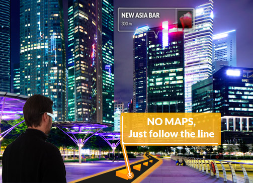
Wikitude Navigation was a proof of concept project with the worlds first pedestrian and car navigation system that integrates an augmented reality display and eliminates the need for a map. First released in 2010, and originally titled “Drive,” Wikitude Navigation has won multiple awards, and been hailed as a “revolutionary step forward” in the navigation and guidance field.
by Wikitude

Using a unique augmented reality display, Wikitude Navigation presents users with precise turn-by-turn GPS based guidance, with the added convenience and safety benefits of never having to take their eyes off where they’re going. Previous awards for Wikitude’s AR Navigation system include: “Galileo Master 2010” of the European Satellite Navigation Competition, “Global Champion” of the NAVTEQ LBS Challenge and Winner of the “World Summit Award 2010”.
Wikitude Navigation is the worlds first and only augmented reality based GPS navigation system. With precise turn-by-turn directions overlaid onto a real world image, Wikitude Navigation provides users with a unique way to navigate their world, with the added safety benefits of never having to take their eyes off of their destination.
In addition to displaying a real-world view navigation system, integration with over 7000 individual content providers allows Wikitude Navigation to both navigate and inform users of their surroundings.
Initially debuted as a smartphone product, Wikitude Navigation (then “Drive”) holds tremendous value and potential for manufacturers of wearable display technology, as well as software creators that are looking to make their application stand out amongst others.
The Wikitude Drive app was a proof of concept project is no longer available for download or testing.
Interested in creating an AR project of your own?
Talk to one of our specialists and learn how to get started.